
Instructions: Click on the button to see if your answer is correct or not. I recommend keeping track of how many you get correct on your first try. You might need your reference tables for this... look in the back of your book, starting on page 265.
The Richter scale
The Mercalli scale
The seismograph
The barometer
Richter scale
Mercalli scale
Beaufort scale
Torino Impact Hazard Scale
Richter scale
Mercalli scale
Beaufort scale
Torino Impact Hazard Scale
Observing the local topography.
Reading historical observations of the event.
Measuring the rate at which heat escapes from the Earth.
Measuring the strength of the Earth's gravitational field.
Why does the P-waves of earthquakes arrive at a location before the S-waves?
The P-waves are created at the focus long before the S-waves are created, allowing the P-waves to get there first.
The velocity of the P-waves is higher than the velocity of the S-waves.
The S-waves are created before the P-waves at the focus, but move so slowly that the P-waves will catch up to, and eventually, pass the S-waves.
Since S-waves cannot travel through solid rock, the P-waves can travel outward while the S-waves are forced to go through the liquid outer core.
What happens to the velocity of P-waves and S-waves if there is an increase in the density of the materials that they are traveling through?
The P-waves slow down, but the S-waves speed up.
The P-waves speed up, but the S-waves slow down.
Both the P-waves and the S-waves slow down.
Both the P-waves and the S-waves speed up.
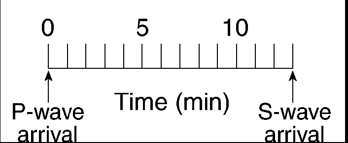
An earthquake's P-wave traveled 4,800 kilometers and arrived at a seismic station at 5:10 p.m. At approximately what time did the earthquake occur?
5:18 p.m.
5:10 p.m.
5:02 p.m.
5:08p.m.
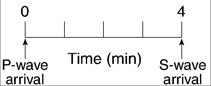
Approximately how long does an earthquake P-wave take to travel the first 6500 kilometers after the earthquake occurs?
8.0 min
10.0 min
6.5 min
18.5 min
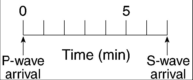
What is the average velocity of an earthquake's S-wave in its first 4 minutes of travel?
500 km/min
250 km/min
4 km/min
1 km/min
Which set of Earth processes are thought to be most closely related to each other because they normally occur in the same zones?
mountain building, earthquakes, and volcanic activity
volcanic activity, rock weathering, and deposition of sediments
earthquakes, shallow-water fossil formation, and shifting magnetic poles
mountain building, shallow-water fossil formation, and rock weathering
On December 26, 2004, a series of tsunamis, with waves up to 100 feet (30 meters) high, hit Indonesia, Sri Lanka, India, Thailand, Mayanmar, and 6 other countries, killing over 225,000 people. What was the cause of these tsunamis?
A huge typhoon in the middle of the Indian Ocean with wind speeds of over 190 miles/hour (305 km/hr or 165 knots).
An earthquake with a magnitude between 9.1 and 9.3 on the Richter Scale that occurred somewhere along the floor of the Indian Ocean.
A collision of ocean currents near the Indian Ocean.
A high-pressure weather system over 1402.3 millibars.
On which plate is the Hawaii Hot Spot located?
Pacific
North American
African
Nazca
What is the direct cause of most earthquakes?
heat exchange between the crust and the atmosphere
gravitational pull on bedrock by the Moon
movement of bedrock along a fault line
deposition of sediment in lakes and oceans
What type of plate boundary exists between the African Plate and the Antarctic Plate?
transform
complex
divergent
convergent
Which evidence causes most scientists to believe that seafloor spreading occurs at the mid-Atlantic Ridge?
Oceanic crust is oldest at the ridge.
Large sedimentary folds exist in the mantle near the ridge.
Oceanic crust on both sides of the ridge is less dense than continental crust.
Oceanic crust on both sides of the ridge shows matching patterns of reversed and normal magnetic polarity.
The theory of continental drift suggests that the
present-day continents of South America and Africa once fit together like puzzle parts
continents moved due to the Coriolis effect caused by the Earth's rotation
continents moved due to changes in the Earth's orbital velocity
present-day continents of South America and Africa are moving toward each other
Evidence of crustal subsidence (sinking) is provided by
marine fossils on mountaintops
shallow-water fossils beneath the deep ocean
zones of igneous activity at mid-ocean ridges
heat-flow measurements on coastal plains
The best evidence of crustal uplift is provided by
marine fossils found in the bedrock of some mountaintops
shallow-water marine fossils found in deep ocean water
thick layers of sediment on the ocean floor
horizontal sedimentary layers
Why is Earth�s outer core inferred to be a liquid?
P-waves cannot pass through the outer core.
P-waves can pass through the outer core.
S-waves cannot pass through the outer core.
S-waves can pass through the outer core.
Which of the following is located at a converging plate boundary?
Iceland Hotspot
Marianas Trench
Southwest Indian Ridge
Sandwich Plate
Compared to Earth�s crust, Earth�s core is believed to be
less dense, hotter, and composed of less iron
less dense, cooler, and composed of more iron
more dense, cooler, and composed of less iron
more dense, hotter, and composed of more iron
What is the approximate temperature at the mantle-outer core boundary?
1,500�C
4,500�C
5,000�C
7,000�C
The pressure at the interface between the mantle and the outer core of Earth is inferred to be approximately
1.4 million atmospheres
3.4 million atmospheres
3.0 million atmospheres
1.0 million atmospheres
What is the minimum number of seismic stations needed to find the epicenter of an earthquake?
1
2
3
4
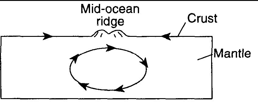
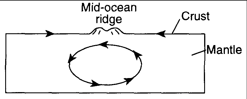
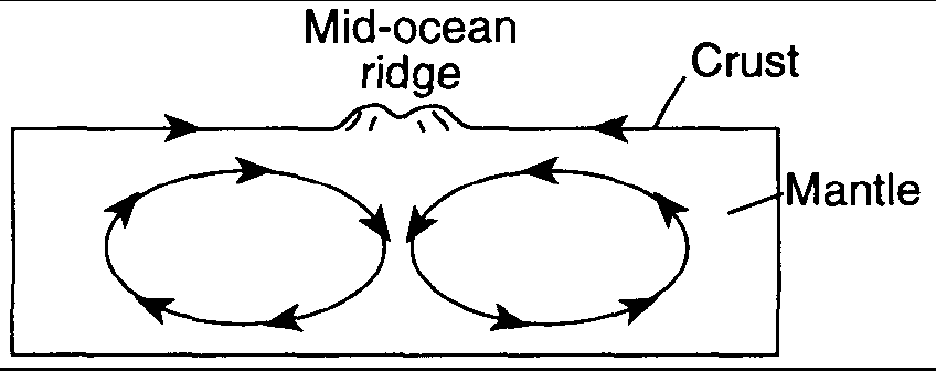
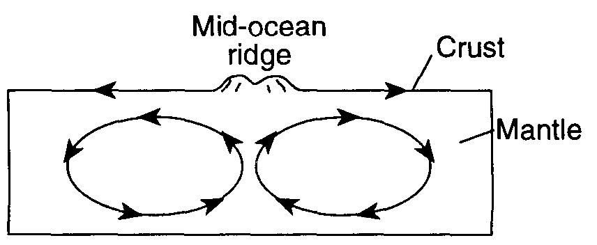
Which cross-sectional diagram of a portion of the crust and mantle best shows the pattern of mantle convection currents that are believed to cause the formation of a mid-ocean ridge?
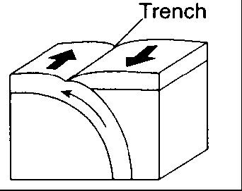
Base your answer on the map below, which shows the location of the Peru-Chile Trench.
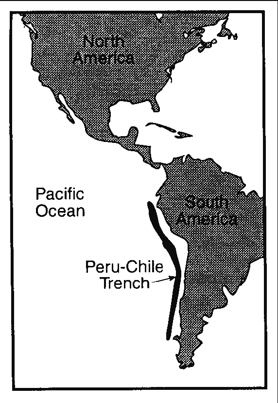
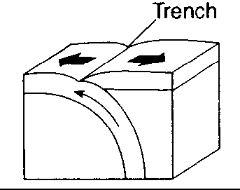
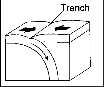
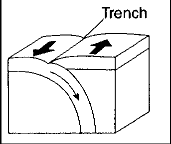
In which diagram do the arrows best represent the motions of Earth's crust at the Peru-Chile Trench?
Which cross-sectional diagram of Earth�s asthenosphere best shows the convection currents that would cause crustal plate X to drift away from crustal plate Y?
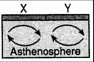

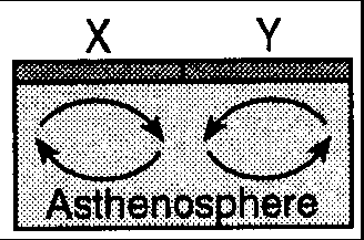
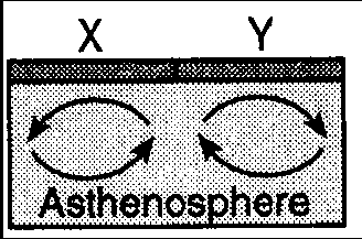
Which cross-sectional diagram of Earth�s asthenosphere best shows the convection currents that would cause crustal plate X to towards crustal plate Y?
Base your answer on the map below. The map represents the movement of tectonic plates that resulted in the collision of India with Asia. Scientists believe that 71 million years ago, India was at position A.
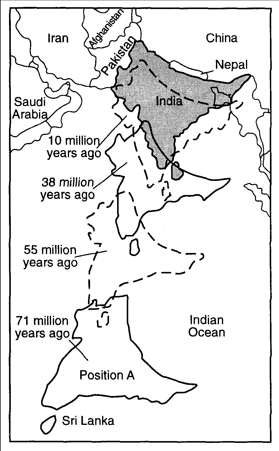
Which present-day geologic feature in Nepal resulted from this collision?
an oceanic trench
a mountain range
a rift valley
an oceanic ridge
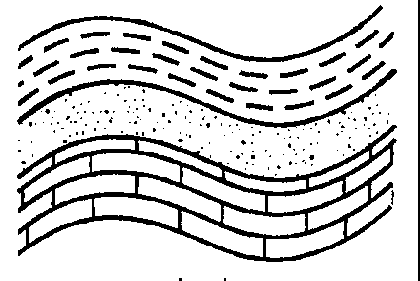
The diagram below shows a portion of the Earth's crust.
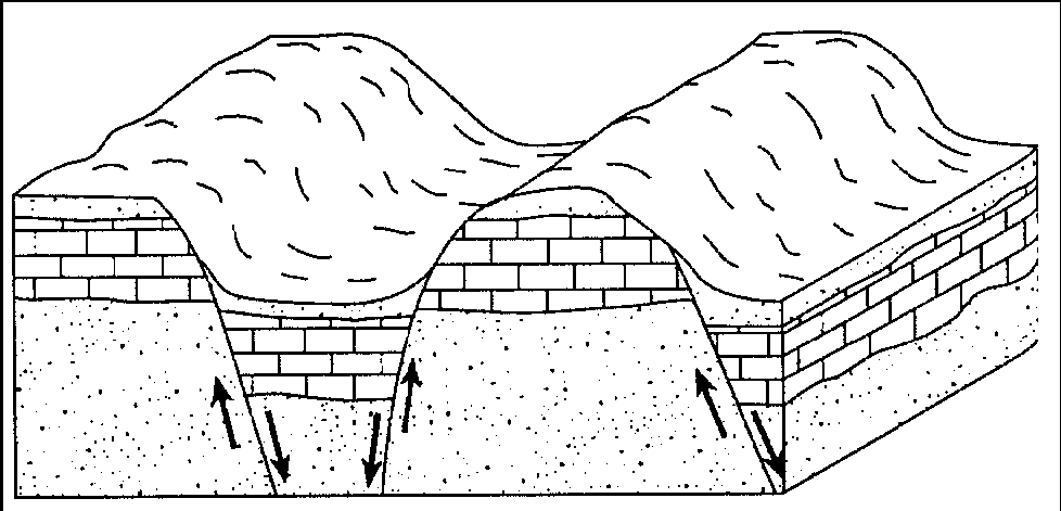
The movements indicated by the arrows represent the process of
metamorphism
volcanism
folding
faulting
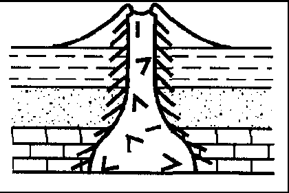
The cutaway diagram below shows the paths of earthquake waves generated at point X.
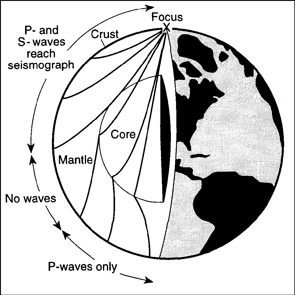
Only P-waves reach the side of Earth that is opposite the focus because P-waves
are stronger than S-waves
travel faster than S-waves
travel faster than S-waves
can travel through liquids and S-waves cannot
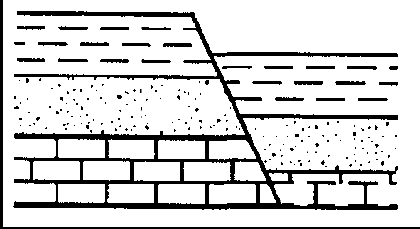
The diagram below represents a section of the Earth's bedrock. The arrows show the direction of forces that are gradually compressing this section.
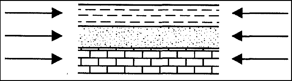
Which diagram represents the most probable result of these forces?

The diagram below shows land features that have been disrupted by an earthquake as seen from overhead.
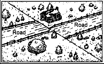
Which type of crustal movement most likely caused the displacement of
features in this area?
folding of surface rock
vertical lifting of surface rock
down-warping of the crust
movement along a transform fault
The map below shows the present-day locations of South America and Africa. Remains of Mesosaurus, an extinct freshwater reptile, have been found in similarly aged bedrock formed from lake sediments at locations X and Y.

Which statement represents the most logical conclusion to draw from this evidence?
The continents of South America and Africa were joined when Mesosaurus lived.
The present climates at locations X and Y are similar.
Mesosaurus migrated across the ocean from location X to location Y.
Mesosaurus came into existence on several widely separated continents at different times.
Which diagram best shows the type of plate boundary found between the China Plate and the Philippine Plate?

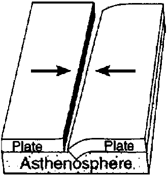


Which diagram best shows the type of plate boundary found between the South American Plate and the African Plate?
Which diagram best shows the type of plate boundary found between the Pacific Plate and the North American Plate?
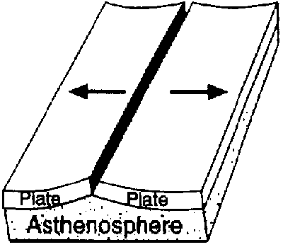

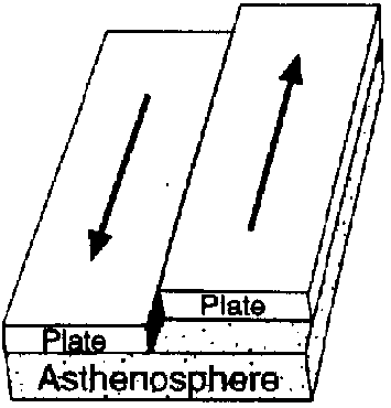
Which diagram most likely shows the type of plate boundary found between the Eurasian Plate and the North American Plate?
Which diagram best shows the type of plate boundary found at the Aleutian Trench?
Which diagram best shows the type of plate boundary found at the Mariana Trench?
Which diagram best shows the type of plate boundary found at the Peru-Chile Trench?
Which diagram best shows the type of plate boundary found at the Mid-Atlantic Ridge?
Which diagram best shows the type of plate boundary found at the East Pacific Ridge?
Which diagram best shows the type of plate boundary found at the Southwest Indian Ridge?
Which diagram best shows the type of plate boundary at the East African Rift?
Which diagram best shows the type of plate boundary at the San Andreas Fault?
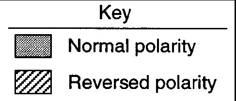
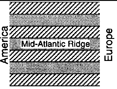
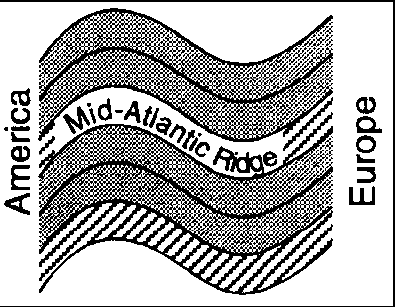
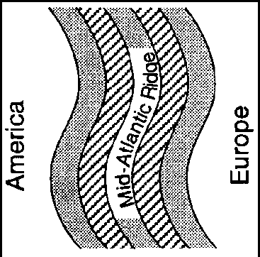
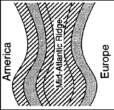
Which map best represents the general pattern of magnetism in the oceanic bedrock near the mid-Atlantic Ridge?
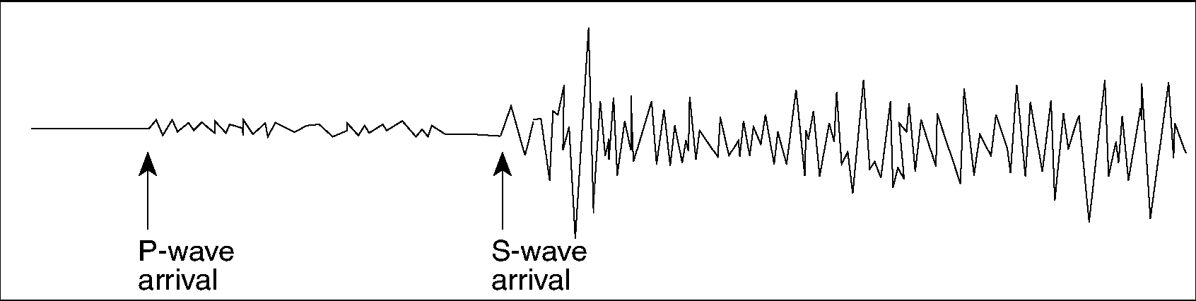
The diagrams below show demonstrations that represent the behavior of two seismic waves, A and B.

Which statement concerning the demonstrated waves is correct?
Wave A represents compressional waves in the crust, and wave B represents compressional waves in the mantle.
Wave A represents a compressional wave, and wave B represents a shear wave.
Wave A represents shear waves in the crust, and wave B represents shear waves in the mantle.
Wave A represents a shear wave, and wave B represents a compressional wave.
![]()
Base your answers to questions 49 through 51 on the diagram and map below. The diagram shows three seismograms of the same earthquake recorded at three different seismic stations, X, Y, and Z. The distances from each seismic station to the earthquake epicenter have been drawn on the map. A coordinate system has been placed on the map to describe locations. The map scale has not been included.
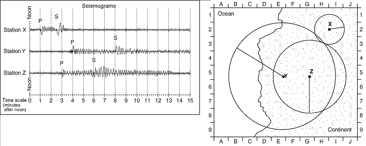
On the map, which location is closest to the epicenter of the earthquake?
E�8
G�1
H�3
H�8
The S-waves from this earthquake that travel toward Earth�s center will
reach the other side of Earth faster than those that travel around Earth in the crust.
be absorbed by the liquid outer core.
be totally reflected off the crust-mantle interface.
be deflected by Earth�s magnetic field.
Seismic station Z is 1,700 kilometers from the epicenter. Approximately how long did it take the P-wave to travel to station Z?
1 min 50 sec 2 min 50 sec 3 min 30 sec 6 min 30 sec
![]()
Base your answers to questions 52 through 56 on the Earth Science Reference Tables and the diagram below. The diagram shows the magnetic orientation of igneous rock on the seafloor on the east (right) side of a mid-ocean ridge. The pattern on the west (left) side of the ridge has been omitted. The age of the igneous rock and its distance from the ridge center are shown.
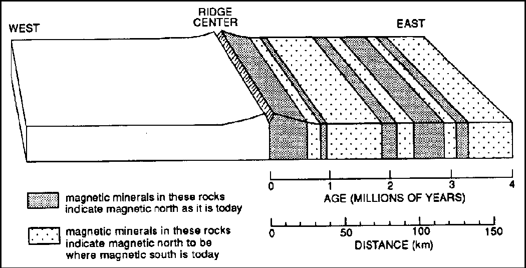
The occurrence of high-heat floors at the ridge center provides evidence of the
destruction of continental crust
destruction of oceanic crust
existence of rising mantle convection currents
existence of ancestral mountains
According to the diagram, what is the approximate rate of seafloor spreading?
1 km/million years
2 km/million years
40 km/million years
50 km/million years
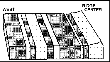
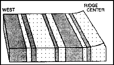
Which diagram below best represents the pattern of magnetic orientation in the seafloor on the west (left) side of the ocean ridge?
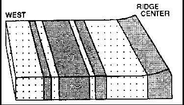
Which inference can best be made from the diagram?
The amount of fossil material preserved in the igneous rock has changed with time.
The orientation of the Earth's magnetic field has reversed with time.
The size of the continents has changed with time.
The elevation of sea level has changed with time.
As distance from the center of the ridge increases, the age of the rocks
increases.
decreases.
remains the same.
![]()
The block diagram below shows the bedrock age as measured by
radioactive dating and the present location of part of the Hawaiian Island
chain. These volcanic islands may have formed as the Pacific Plate moved
over a mantle hot spot.
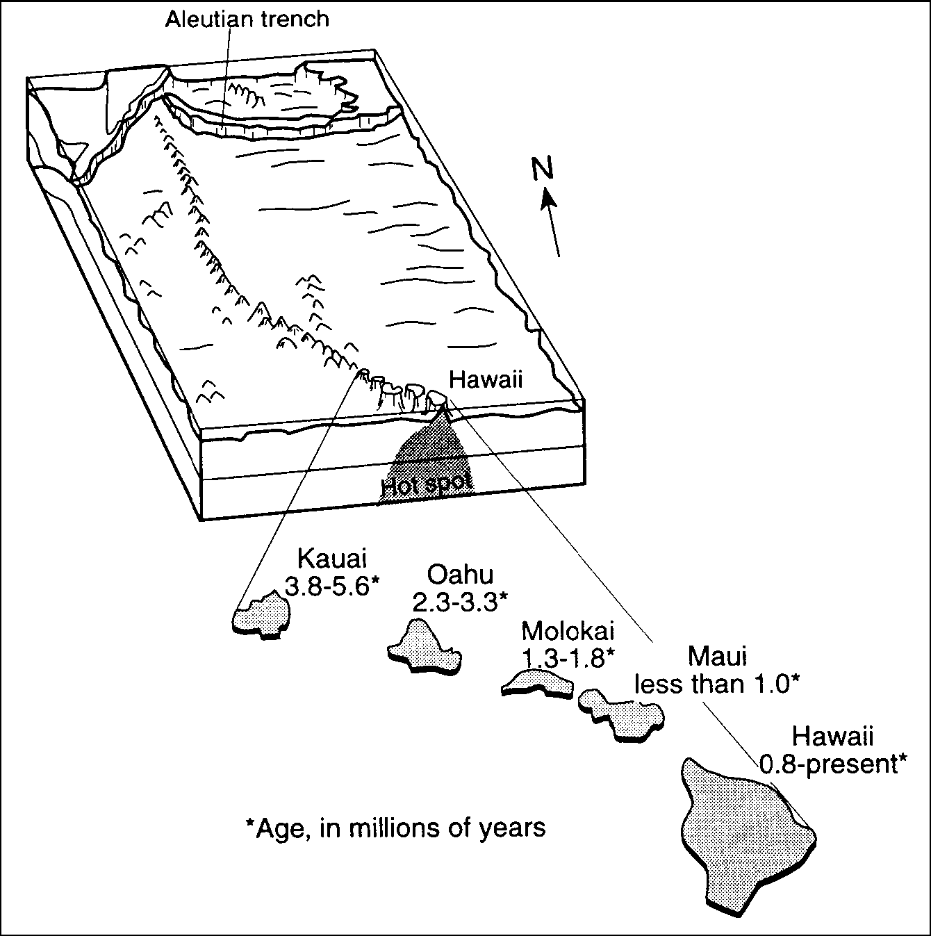
This diagram
provides evidence that the Pacific Crustal Plate was moving toward the
southeast
northeast
southwest
northwest
![]()
The seismogram below shows the arrival times of an earthquake's P-wave and
S-wave recorded at a seismic station in Portland, Oregon.
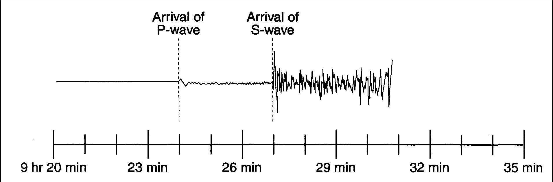
What was the distance from Portland to the earthquake's epicenter?
1800 km
2500 km
3200 km
4100 km
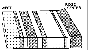
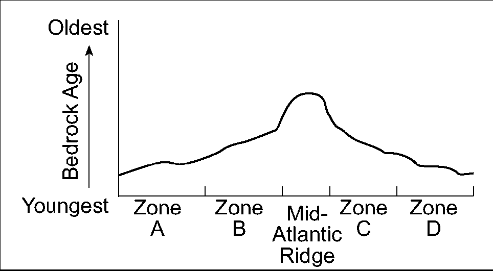
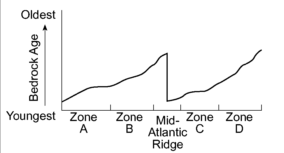
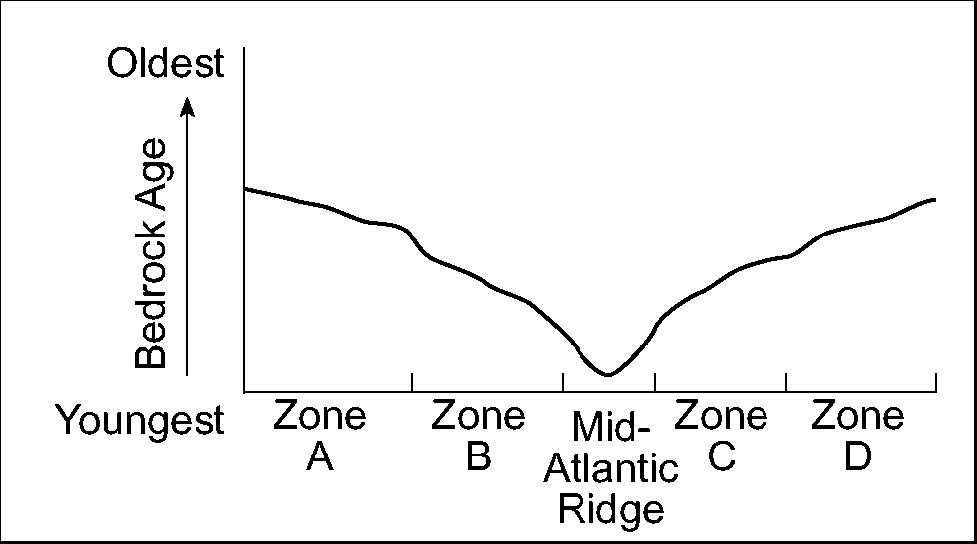
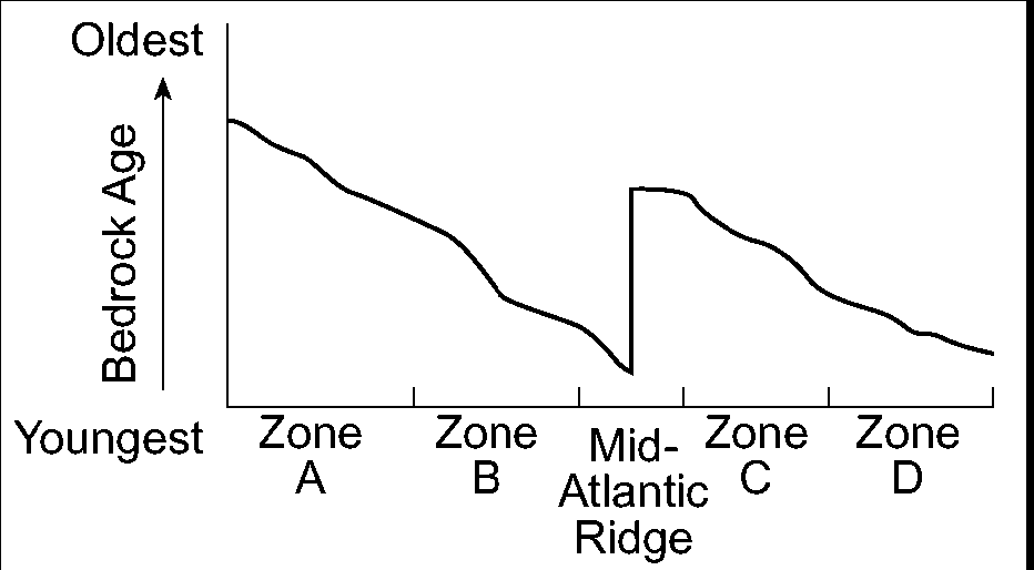
The map below shows the Atlantic Ocean divided into zones A, B, C, and D. The Mid-Atlantic Ridge is located between zones B and C.
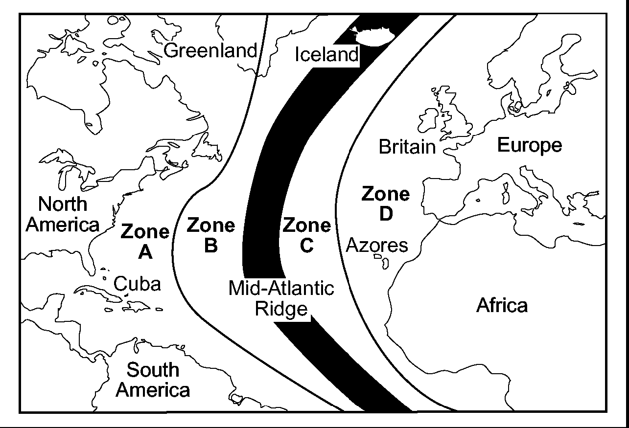
Which graph best represents the geologic age of the surface bedrock on the ocean bottom?
![]()
Base your answers to questions 59 and 67 on the diagrams below of geologic cross sections of the upper mantle and crust at four different Earth locations, A, B, C, and D. Movement of the crustal sections (plates) is indicated by arrows, and the locations of frequent earthquakes are indicated by . Diagrams are not drawn to scale.
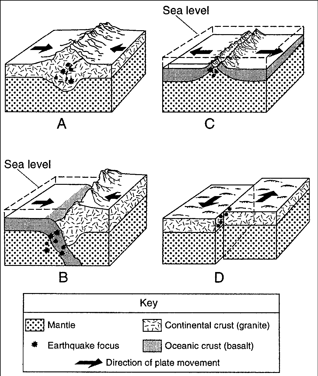
Which location best represents the boundary between the African plate and the South American plate?
A
B
C
D
Which diagram represents plate movement associated with transform faults such as those causing California earthquakes?
A
B
C
D
Which location best represents the boundary where subduction occurs?
A
B
C
D
Which location best represents the boundary where orogeny occurs?
A
B
C
D
Which location best represents the boundary where rifting occurs?
A
B
C
D
Which location best represents the boundary that causes volcanic chains?
A
B
C
D
Which location best represents the type of boundary where new crust is created?
A
B
C
D
Which location best represents the type of boundary where a deep ocean trench can be found?
A
B
C
D
Which location best represents the type of boundary where a mid-ocean ridge can be found?
A
B
C
D
![]()
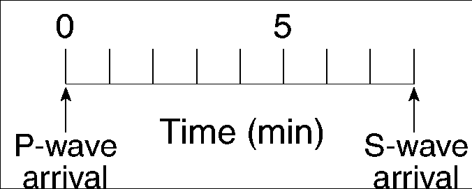
The diagram below is a seismogram of the famous San Francisco earthquake of
1906, recorded at a seismic station located 6,400 kilometers
from San Francisco.
Which time scale best represents the arrival-time difference between P-waves and S-waves at this station?
yes buttons